About Vignemale Rando3D
MASSIF VIGNEMALE Hautes Pyrénées (65) 3D map Panticosa sector (Spain) Ossoue (Gavarnie) and Valley Marcadau (Bridge of Spain) at the Grand Barbat. LIST OF HIKING 1 - Refuge and Lake Estom 2 - Pic d'Ar
MASSIF VIGNEMALE
Hautes Pyrénées (65)
3D map Panticosa sector (Spain) Ossoue (Gavarnie)
and Valley Marcadau (Bridge of Spain) at the Grand Barbat.
LIST OF HIKING
1 - Refuge and Lake Estom
2 - Pic d'Ardiden
3 - Lakes Estom Soubiran - Gentianes from the Sanctuary Estom
4 - Lakes High Peak Estibe
5 - Pic Mayouret
6 - Refuge Oulettes and Baysselance by Valley Gaube
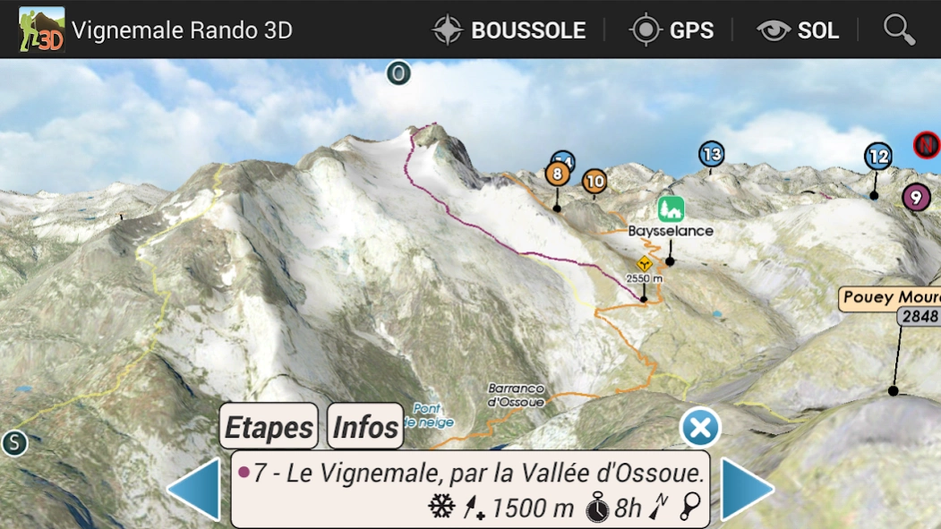
7 - The Vignemale, the Valley Ossoue
8 - Petit Vignemale from the Refuge Oulettes
9 - The Pic of Isardères by the Vallon-Pouey Trénous
10 - From the Refuge Wallon Refuge Oulettes, the Col des Mules
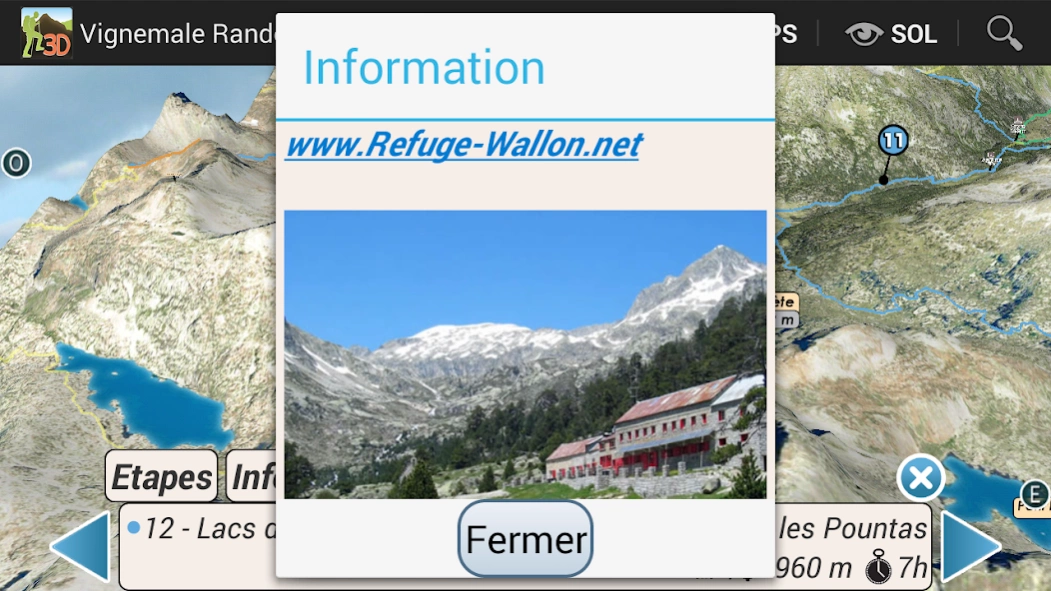
11 - Refuge Wallon
12 - Lakes Embarrats, the Pourtet and Nere, from Pountas
13 - Lakes Cambalès and Opal, from the Refuge Wallon
14 - Port Marcadau the North Muga from the Wallon refuge
3D Hiking Guide
interactive and immersive application.
Take full advantage of this embedded hiking guide and map realistic.
The description of routes is detailed in dynamic 3D illustration.
All features are easy to use and accessible OFFLINE mountain oblige.
Good hiking at all.
IMMERSIVE 3D FEATURES
○ intuitive and precise controls ... fingertips.
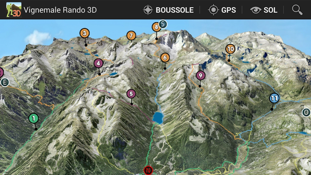
○ Aerial View, overview
○ View and taxiing
○ Compass
○ Geolocation
& DESIGN GUIDE
○ precise descriptions, text and visuals
○ Steps
○ Live View in 3D
GPS
The GPS of your phone is used for geolocation on the map area, it is particularly useful to see its position in the terrain, especially in poor visibility on the ground.
COMPASS
The compass mode is integrated in 3D, the cardinal points are oriented according to the manual movements or map automatically orients the north by activating the compass mode directly from the 3D.
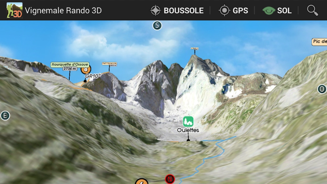
RELIEF IN SIGHT & 3D SOL
The aerial view and floor to illustrate the general view raised to a level of precision optimized, it is displayed on the screen depending on the definition of the relief and texture chosen to launch the application automatically loaded or select according to device capabilities used.
The movement of the floor camera can appreciate the details of the route to follow and total immersion in the relief.
TRACKS
In addition to hiking described, variations and alternative routes, you can import your tracks in GPX 3D map
Sheets and photos of Lakes, Sheds and Shelters
with the assistance of:
www.pyrenees-refuges.com
www.lacsdespyrenees.com
3D Interactive Application hiking guide - Facing the South TOPOMAP3D ® ® www.faceausud.com
Trademark and patented models 486299 08082013 - 12 3953606 © All rights reserved - No copying
With the kind of Helge Foerster JPCT 3D engine ® www.jpct.net Copyright © 2010
Previous Versions
Here you can find the changelog of Vignemale Rando3D since it was posted on our website on 2023-03-05 14:25:25.
The latest version is 1.0 and it was updated on 2024-04-22 17:19:19. See below the changes in each version.
Vignemale Rando3D version 1.0
Updated At: 2016-08-05
Changes: Mise à jour du contenu.
Disclaimer
Official Google Play Link
We do not host Vignemale Rando3D on our servers. We did not scan it for viruses, adware, spyware or other type of malware. This app is hosted by Google and passed their terms and conditions to be listed there. We recommend caution when installing it.
The Google Play link for Vignemale Rando3D is provided to you by apps112.com without any warranties, representations or guarantees of any kind, so access it at your own risk.
If you have questions regarding this particular app contact the publisher directly. For questions about the functionalities of apps112.com contact us.